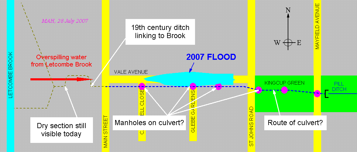
The upper part of Pill Ditch is enclosed in a culvert whose entrance lies on Kingcup Green just west of Mayfield Avenue. The schematic below shows the likely course of the culvert (dashed blue line). This is based on the location of old man-hole covers (purple) that may provide maintenance access to the culvert and the course of Pill Ditch shown on 19th century maps, in particular the 1:2500 OS map of Berkshire, dated 1877.
Later maps provide further evidence. For example, a 1:10560 map, dated 1900, again shows the curved ditch north of Bosley's Orchard, but with the addition of the Methodist Church. This is shown just north of the ditch between the curved section and Main Street. This allows us to locate the course of the Ditch just south of the present Church. Another useful old map is the OS one-inch map series for the Wantage area. The New Popular Edition of 1940 (Sheet 158, Oxford and Newbury) shows the ditch as an open stream (marked in blue) immediately east of Main Street.
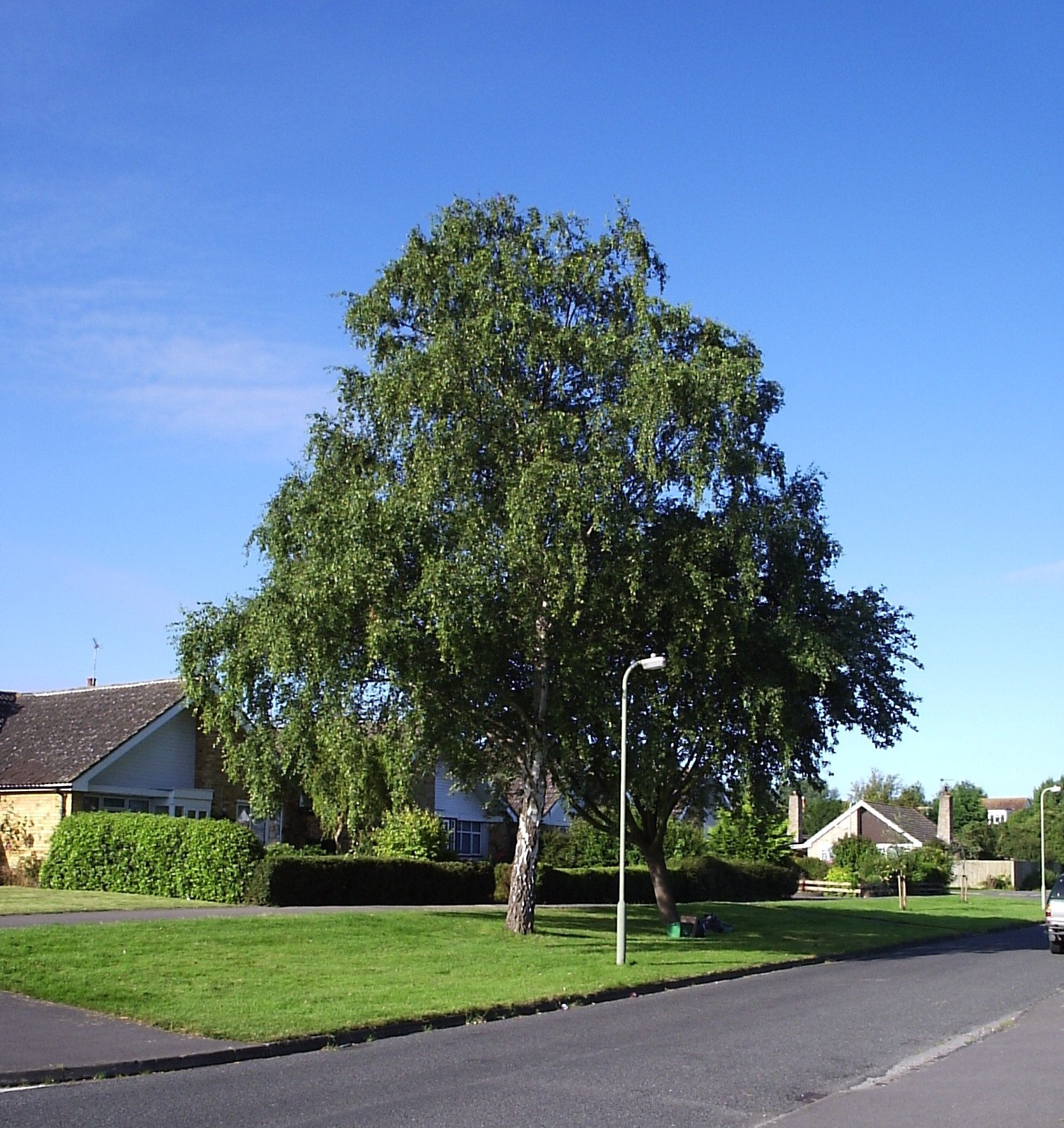
Another indicator of the old course of Pill Ditch in Vale Avenue was a line of old willow trees that existed until a few years ago. Sadly most have now been felled, leaving just one as shown in the picture below.
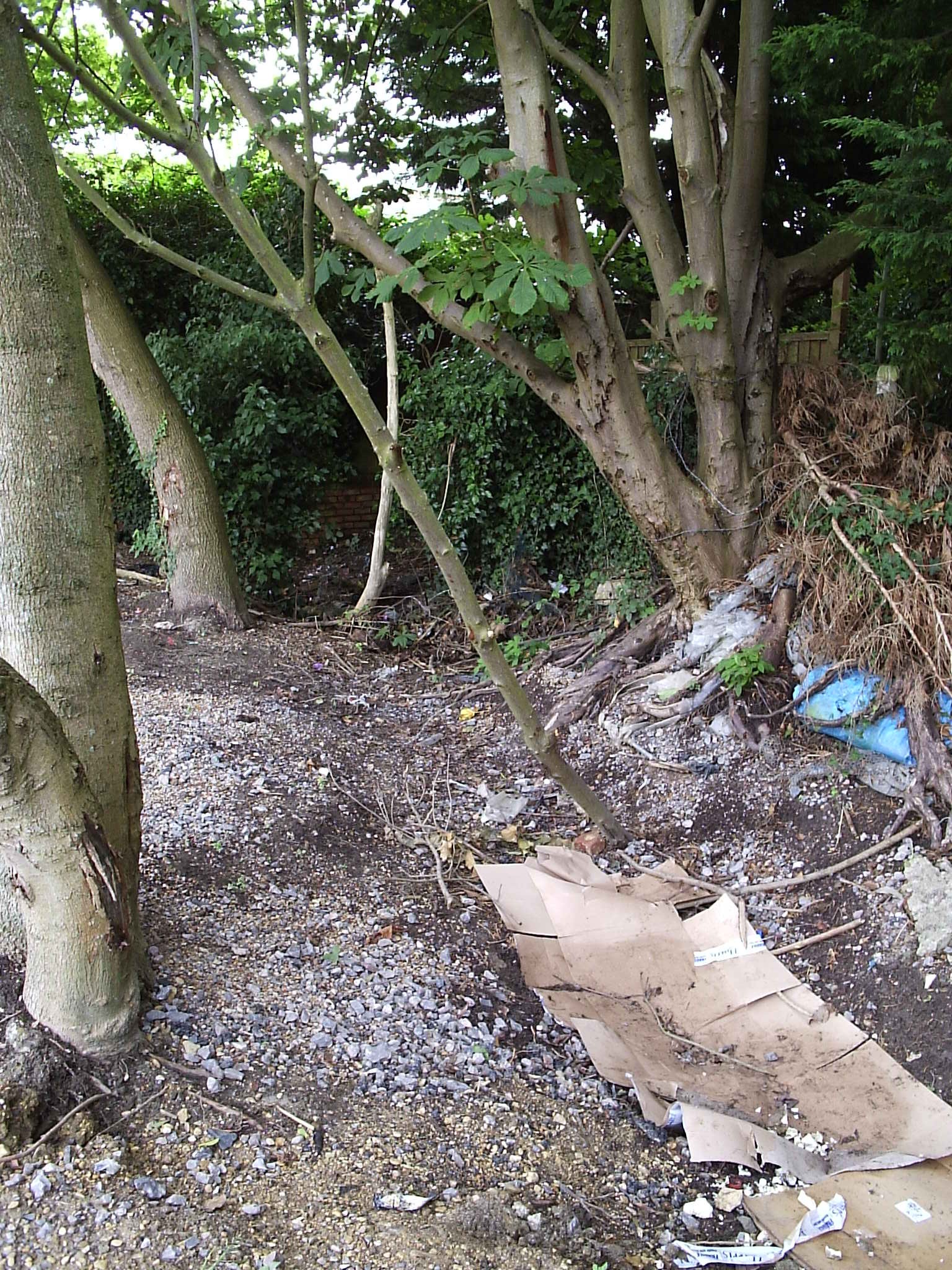
Thus it is clear there was a curved ditch (dashed brown line on the schematic above) west of Main Street and on the north side of Bosley's Orchard. This linked Pill Ditch to Letcombe Brook. The western part of this ditch corresponds to the dried-up ditch that can still be seen behind the shops at Millbrook (see below). The 2007 flood waters followed this old watercourse before spilling into Vale Avenue.
For an interactive map of Pill Ditch in Grove follow this link.
The 1877 map is also interesting in the land adjacent to Letcombe Brook (the present Mary Green and playground) is clearly marked as "Liable to Floods".